OTZIAS beach & anchorage in KEA (TZIA)
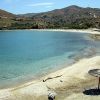
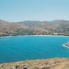
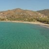
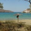
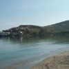
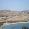
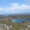
Otzias is a nice long beach found at the northern coast of the large so-named round bay. It is sandy with transparent blue-green waters and trees on the shore. The beach extends to about 700 meters. It is not organised but a few umbrellas are provided for free. Otzias is also the name of the small so-named settlement. There are also a couple of nice tavernas (one of them is among the best in Kea) and a couple of cafe bars on the road behind the beach. The area has also a few rooms to let.
The bay and the beach are open to north winds and in that case the sea is not as attractive as it is with south winds. There are usually wind surfers in this beach and peddal boats can be rented. At the entrance of the bay there are some small picturesque coves with nice waters that one may visit when the weather is calm.
The bay used to be a port in older times and some of its ruins are still visible. Otzias is located apx 11 km from Ioulida and apx 5km from Korissia (main port). At a short distance (1 km) there are some mines called Tripospilies. A few kilometers further there is the imposing monastery of Panagia Kastriani.
There are some interesting paths and lanes around Otzias that are worth exploring. Otzias is also the starting point of one of the best paths in Kea which ends to the famous Lion statue outside Ioulida. One may also walk to the cosmopolitan Vourkari (apx 3 km).
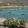
ANCHORAGE INFO: Otzias is protected from South winds but totally exposed to North winds. Beautiful landscape. A few tavernas and cafes on the shore. At the entrance of the bay there are some small isolated coves. Many yachters anchor there or go there with their tenders for swimming when the weather is calm.
HOLDING: Good, sandy bottom
RESTAURANTS in KEA (TZIA) on Google Map with Phots & Description
ANCHORAGES in KEA (TZIA) on Google Map with Nautical Map, Photos & Description
All BEACHES in KEA (TZIA) on Google Map with Photos & Description
Complete TOURIST and SAILING DIRECTORY
